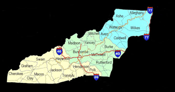
Source:
Clay
County Chamber of Commerce
According to the late J.V.A. Moore,
a local historian, the first white man to settle in what was
to become Clay County, was John Covington Moore. This was
wild country in the second and third decade of the nineteenth
century, abounding with dangers arising from sheer loneliness,
from wild animals, and rough terrain, to say nothing of the
fact that unfriendly Indians roamed across the length and
breadth of the land. It would be impossible to document this
episode, but it seems that no one has contested the distinction
awarded to Mr. Moore.
The first emigrants moved into this
section, which at the time was a part of Macon County, in
the early part of the 1830s with only the protection they
could afford for themselves.
In 1837 General Winfield Scott was
commissioned to "round up" all the Indians throughout
this mountain regions, detain them in improvised stockades
and take them to the Oklahoma Territory, which had been set
apart by the United States Government as an Indian Reservation.
A Captain Hembree was sent to this
section of what was to become Cherokee County (in 1839) and
constructed a stockade about a mile south west of the present
town of Hayesville, where the Indians were held until they
had all been captured and the infamous "trail of tears"
began.
This stockade was called Fort Hembree
and around it grew up a business and civic center where the
people would have the protection of the fort against the few
Indians who had escaped the grasp of Captain Hembree's soldiers.
Exact dates are not available, but
about 1838 there were three churches built in that vicinity.
The first one was erected by the Presbyterian congregation
on ground now known as the Presbyterian Cemetery and/or the
Baptist Cemetery, just south of the town limits of Hayesville;
the second was built by the Baptist on almost the exact spot
where now stands the Church of God building and in short order
the Methodist built a church about the center of what is now
the Hayesville Methodist Cemetery.
The first post office in the southeastern
end of what was then Cherokee County, was established in this
general area and called Fort Hembree. It was opened January
8, 1844 with Jason S. Hyatt as the first postmaster. Others
who succeeded Hyatt in this office were: William A. McCrary,
William M. Sanderson, Joel Bowling and Robert B. Chambers
(in that order). The Fort Hembree post office was discontinued
as of December 6, 1866.
Counties do not beget counties; the
State Legislature just takes a "rib" from one county
and creates another. This process has been going on in North
Carolina, in rather a haphazard fashion ever since 1791, when
a sizable "rib" was carved out of Burke County,
out of which the county of Buncombe was created.
As the white man moved farther and
farther west, the population became more remotely located
with reference to the center of government and the reach of
protective agencies such as sheriffs' departments and the
state militia. So, in 1808, in order to meet some of the urgent
needs of the rugged pioneers, adolescent Buncombe suffered
the loss of a "rib" under the legislative scalpel
from which was created Haywood County.
A constant stream of people, hardy
people, brave people, people looking not so much for fortune;
but for a place where they would carve out for themselves
a likelihood and a home, free from the dictates of circumstances
that had followed them from distant shores, flocked to his
region. Thus in 1828 another operation set up the chartering
of yet another new county, which was called Macon.
With the head of steam already built
up in the great Westward movement, it is understandable that
it just took Macon eleven short years to "out grow their
britches" to the extent that in 1839 the General Assembly
whacked off a considerable portion of Macon County's territory
and called it Cherokee County.
Growing pains had already set in and
in 1861 Clay County, N.C. had its birth. Back in the middle of the nineteenth century most of the area
which now comprises Clay County, North Carolina, was a part
of Cherokee County. Probably the most pressing argument for
the forming of a new county was the fact that people living
in the far eastern end of the county (Cherokee) could not
travel to Murphy, the county seat, transact legal business
in the courthouse and return home in one day's journey. It
must be remembered that the only methods of travel were afoot,
on horse-back or in a horse drawn vehicle.
Mr. George Hayes, who lived in the
general area of Tomotla, was running for Representative from
Cherokee County in the Fall election of 1860. It seems that
he was having an uphill fight in his home territory; but when
he brought his campaign to the southeastern end of the county,
he found that his constituents here wanted separation from
Cherokee County and a county seat of government of their own.
By promising them that he would introduce legislation to form
a new county, he captured most of the votes in this area and
was able to swing the election. So in February of 1861 such
legislation was introduced and passed by the North Carolina
General Assembly.
In recognition for his services in
helping create the new county, the county seat was named Hayesville
in honor or Mr. Hayes. The new county was named in honor of
the great Kentucky statesman, Henry Clay.
For the most part, Clay County was
taken from the then Cherokee County. However, there was a
small area taken from Macon County, moving the Macon County
line from the crest of Chunky Gal Mountain to the divide between
the Buck Creek watershed and that of the Nantahala River.
Probably due to the unrest and uncertainties
growing out of the Civil War together with a lack of initiative
on the part of would-be leaders and office-seekers, a formal
government for the new county was not organized and a full
slate of officials elected until 1868. This same year, May
7, 1868, a post office opened at Hayesville. Prior to this
there had been post offices serving what is now Clay County
at: Fort Hembree (1844), Tusquittee (1848), and Shooting Creek
(1849).
Neighborhood post offices sprung up
in rapid succession, until there was a total of 17 other offices
established within the bounds of Clay County. They were usually
operated from a corner in a cross-road store or even in the
dwelling house of the post master. These small post offices
served the people for several years, until the advent of the
Rural Free Delivery Service which was brought to this area
in 1903, when Route Number One from the Hayesville office
was established. Within a year there were four rural routes
going out from the Hayesville office. The small rural post
offices were discontinued one by one, until, today (1976)
there are only three post offices in the entire county: Hayesville,
Brasstown and Warne.
In order to have not only the conveniences
of life; but the bare necessities, on which to even exist,
a people has to either grow their products, manufacture them
or transport them. Until well after "the turn of the
century", as the "old-timers" used to speak
of the year 1900, everybody grew most of their food stuffs
on their own farm. They made their furniture from lumber cut
in their own forest and their clothes from cloth woven in
their home looms from wool garnered from sheep that they raised
in their own pastures.
Every house-hold had a milk cow, fattened
hogs for their meat supply and maintained a flock of hens
for eggs and meat. Until about 1920, most of the county had
"open range" for their cattle. By that is meant,
farmers had to build fences around the fields on which they
expected to raise cultivated crops and they turned their cattle,
hogs and sheep loose on whatever other land was available,
whether it was their land or someone else's. Many larger farmers
and cattlemen would drive great herds of cattle, hogs and
sheep to the mountains during the summer months, where they
would grow and stay fat on wild vegetation. The mountains
were covered with chestnut trees and the hogs would fatten
on chestnuts and acorns from the mighty oaks. Each farmer
would have a certain mark they would use in order to identify
his stock. Usually this mark consisted of certain kinds and
numbers of nicks in the right or left ear.
They would fasten a bell on their "lead
cow" in order to find the herd more easily. In a frantic effort to increase their acreage for cultivation
and because there was no ready market for their timber, it
was a common practice to cut down entire forests, pile up
the logs and burn them. In many cases there would not be time
for a complete clearing, so they would cut a ring around the
biggest trees in order to kill them. It was a common sight
as late as in the 1920s to see a big field of corn with giant
oaks and poplars scattered over the field that had been killed
and left there to decay.
During the last quarter of the nineteenth century and before,
the citizenry of this mountain region came to realize that
there were many items of necessity that they could neither
grow on their farms nor make from their crude products. Among
these such items as: farm tools and machinery, tools with
which to build homes, clothing and shoes of a finer quality
than they were able to make in their homes, salt, sugar, sewing
thread and a few occasional nick-nacks.
Some of the tallest tales to be heard
by the "golden age club" of the early 1900s were
reminiscence of those long hard wagon journeys "across
the mountain" to Clarksville, Toccoa and even as far
as Gainesville, Ga. Their load "going down", as
the pioneer would say it, consisted of: dried apples, dried
beans (better known as leather britches), clay peas, dried
pumpkin, country cured hams and side meat, and rations enough
to last them and their "stock" for three weeks.
On their return trip they would bring
back such items as green coffee beans, sugar, salt, enough
calico cloth to make each of the family's women folk a new
Sunday dress. Except for one nice Sunday dress, the women
of the house made their dresses as well as the men's clothes
from rough cloth made on their home loom. More often than
not among the items purchased on these long hard treks across
the mountains would be a few small tools; a crosscut saw or
hand saw, a new ax or drawing knife and toward the end of
the nineteenth century it might even have been a sewing machine
or cook stove.
No one was so wise or foolish as to
start this journey alone; not so much for the possible dangers
anticipated but due to the rough terrain, steep a muddy roads
there was always a need to help each other over rough spots.
Each wagon was equipped so that four horses could be hooked
to it; otherwise the entire load might have to be unloaded
before the wagon could be pulled to the top of a hill or through
a deep mud hole. By two or more wagons traveling together,
they could haul almost twice as much with two horses since
they could have the assist of the second team on the rough
spots.
Most of the horses owned by Clay County
farmers prior to 1900 were of the light weight variety; either
saddle horses or coach breeds. However in the early 1900s
several people purchased stallions that were either pure bred
or part Percheron and Belgian. By the time, in the late 1920s
and early 1930s, when the horse was replaced by farm tractors
and trucks, the quality of horses had improved considerably.
The oxen were employed extensively in the early days of the
county, especially for pulling dead weight like logs on the
ground or heavy equipment and grain thrashing machines and
steam engines. They were not suitable for ordinary farm and
road use due to their lack of speed.
Practically every reputable farmer
was his own blacksmith. He could take a pile of scrap iron
and make his own plow point or fire shovel. He could repair
his wagon out on the road and when in his shop could make
his own wagon including the wheels. He could shoe his own
horses and sharpen his tools.
Source:
Clay
County Chamber of Commerce
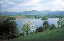
| WNC Outdoors | WNC Waterfalls |