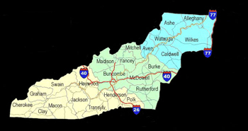
Yancey County was established
in 1833 from Buncombe and Burke Counties. It was named
for Bartlett YANCEY, speaker, orator, educator and friend
of Henry CLAY. Bartlett YANCEY and Henry Clay served in
the US Thirteenth and Fourteenth Congresses, (1813-1817).
Henry Clay, a statesman from
Kentucky, who is famous as a congressional leader and
presidential candidate was to run unsuccessfully for the
President of the United States several times. As the journals
will show, in Congress, the speaker (Mr. Clay) often supplied
his own place by the substitution of Mr. Yancey, see Reminiscences
and Memoirs of North Carolina and Eminent North Carolinians
by Wheeler, John H. (John Hill), 1806-1882.
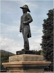
The county seat, Burnsville,
was named for Captain Otway BURNS, who was serving in
the NC legislature and at the cost of his political career,
cast the tie breaking vote to permit new western counties
to be formed and the establishment of Yancey County. He
became a good friend of Bartlett Yancey who was also in
the NC Senate at the time. Bartlett Yancey and Otway Burns
rode horse back over the mountains and viewed the beautiful
area that was to become Yancey County.
Bartlett pointed out to Captain
Otway how the citizens were required to travel the great
distances to the court house in Morganton. John "Yellow
Jacket" Bailey also was very instrumental in the
formation of Yancey County by his unrelenting campaigning
for the new counties to be formed on trips to Raleigh.
He found friends in Bartlett Yancey and Captain Otway
Burns. He later gave the land for the town of Burnsville
and ask that it be named Burnsville in honor of Captain
Otway Burns.
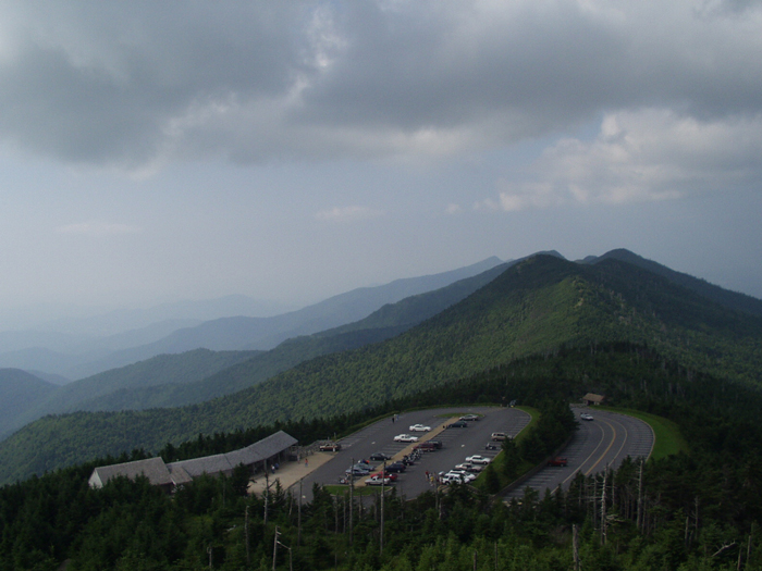
Yancey County is surrounded
by the Blue Ridge area of the Appalachian Highlands. The
Black Mountain Range crosses the south end of the county,
intersected by the Blue Ridge Range and the Unaka Range.
Yancey County has the highest average of elevation of
any county in North Carolina. One of its peaks is Mt.
Mitchell with an elevation of 6,684 feet. The town of
Burnsville is at 2,815 feet.
The population of Yancey County
in 1990 was approximately 19,000 and includes the town
of Burnsville. The county has average temperatures of
22 to 47 degrees in the winter and 80 degrees in the summer.
Average annual rainfall is 84 inches with an average snowfall
of 104 inches. Textile is the main industry of Yancey
County, with seven textile industries located there. There
is also two mining and processing plants, a bedspring
manufacturer and an asphalt plant. Agriculture includes
tobacco, Christmas trees, ornamental shrubs and beef cattle.
As you drive the back roads
of Yancey County, you will find such quaint names as Bee
Log, Hardscrabble, Pig Pen, Possum Trot and Rabbit Hop.
Old mountain ways mingle with the new. We are firmly rooted
in the past and growing toward the future. A great way
of life and a wonderful place to live.